


Navionics® Boating
2.92.48K Reviews
App Specs
- Version
- Varies with Device
- Updated On
- License
- Free
- Downloads
- 5,000,000+
- Developer
- Garmin
- Categories
- Maps & Navigation
- Platform
- Android, iOS
Screenshots
 Analysis by AppCompare
If you've ever found yourself yearning for a reliable companion while navigating the waters, then let me introduce you to Navionics® Boating. This app is like having a seasoned sailor in your pocket, guiding you through the ebb and flow of tides with ease. As an avid boater myself, I couldn’t wait to dive in and see what this app has to offer.
Setting Sail with Navionics® Boating
First things first, getting started with Navionics® Boating is a breeze. The app is available for both Android and iOS, so no matter your device preference, you’re covered. Once downloaded, I was welcomed by a clean, intuitive interface that didn’t overwhelm with too many options right off the bat.
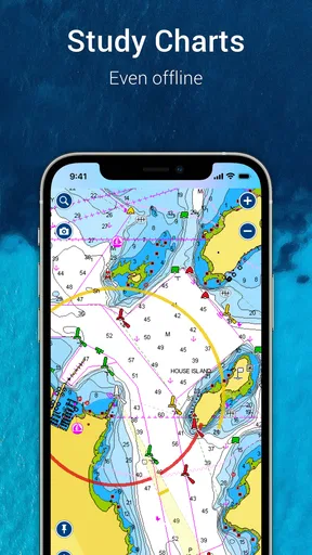
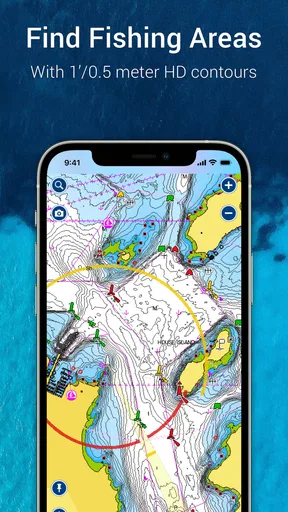
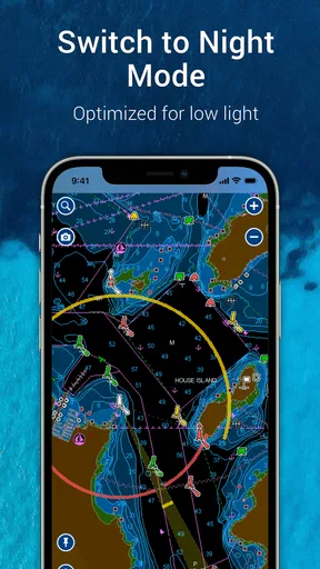
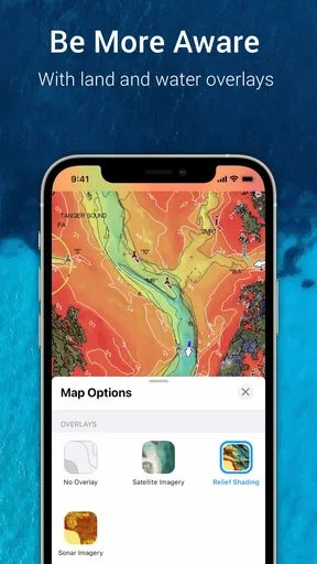
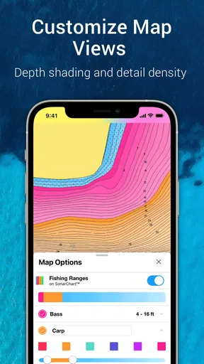
One of the coolest features I noticed right away was the detailed nautical charts. These aren’t your basic maps—they’re rich with information. You can view depth contours, navigational aids, and even high-resolution satellite imagery. It feels like you’re holding a professional-grade tool that’s still user-friendly enough for amateur boaters like me.
Features That Keep You Afloat
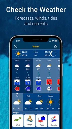
Now, let me tell you about some standout features that truly make this app a keeper. The app offers a comprehensive weather forecast, including wind predictions, tides, and currents. These are essential for planning a safe and enjoyable trip. Trust me, I’ve been caught out by unexpected weather changes before, and it’s no fun.
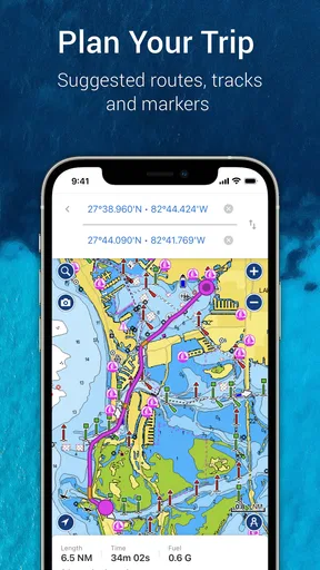
Another nifty feature is the route planning. You can plot your course with waypoints and measure distances. I found myself using this feature a lot, especially when exploring new areas. It’s so satisfying to lay out a route and see it come to life on the map.
For those who love fishing or simply want to keep a log of their journeys, the app offers a logbook function. You can record all sorts of details about your trips, from catches to fuel consumption. It’s like having a digital scrapbook of your adventures on the water.
Staying Connected with the Community
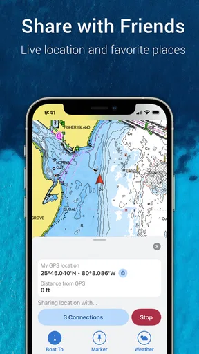
A unique aspect of Navionics® Boating is its community layer. This feature allows users to share information about marine conditions, points of interest, and even hazards. It’s a bit like social media for boaters, and I found it super helpful for getting real-time tips and advice from fellow navigators.
Worth Reading Before You Choose

EA SPORTS FC Mobile 26 Is a Bigger Football Game, but It Takes Time

Flipboard Shows What News Apps Must Do Beyond the Feed

Switching to Android Auto Means Rethinking Your Driving Routine

Google Calendar Makes a Crowded Week Easier to Manage

Ludo King Makes the Most of the Minutes Between Plans

Baby Panda World Brings Quick Play to Modern Phones, but Its Game Library Feels Busy
The app also integrates seamlessly with other devices. If you’re someone who loves tech, you’ll appreciate how you can sync it with your onboard electronics. This means your charts and routes can be displayed on your boat’s multifunction display, making navigation even more streamlined.
Is Navionics® Boating Smooth Sailing?
While the app is packed with features, it’s not without its quirks. Occasionally, I noticed the app could be a bit slow to update charts when zooming in and out. It’s not a major issue, but something to be aware of if you’re in a spot with poor connectivity.
There’s also the subscription model. While the initial download is free, access to premium features like advanced maps and weather requires a subscription. I found the investment worth it, but it’s something to consider if you’re on a tight budget.
In the end, Navionics® Boating feels like an essential tool for anyone serious about their time on the water. Whether you’re a casual weekend sailor or a seasoned mariner, the app offers something for everyone. With its wealth of features, user-friendly interface, and active community, it’s like having a trusty first mate at your side.
So, if you’re ready to embark on your next maritime adventure, why not let Navionics® Boating help chart the course? You can find the download links right here on our site and start exploring the waves with confidence.
Pros
- Comprehensive marine charts available.
- User-friendly interface for navigation.
- Real-time weather updates included.
- Offline mode for areas without signal.
- Community edits for accurate data.
Cons
- Premium features require subscription.
- Charts may need frequent updates.
- Battery consumption can be high.
- Occasional GPS signal delays.
- Limited land-based map details.
FAQs for Navionics® Boating
What platforms is Navionics® Boating available on?
Navionics® Boating is available on both Android and iOS devices. You can download the app from the Google Play Store for Android or the Apple App Store for iOS. Ensure your device meets the minimum operating system requirements for the best experience.
Does Navionics® Boating require an internet connection to function?
While Navionics® Boating offers offline functionality, an internet connection is required for initial map downloads and updates. Once the maps are downloaded, you can access them offline, making it convenient for boating in areas with limited connectivity.
Are there additional costs after downloading Navionics® Boating?
Yes, Navionics® Boating offers in-app purchases and subscription services for additional features. These may include advanced map layers, weather updates, and community edits. It's advisable to review these options to understand potential costs beyond the initial app download.
Can I use Navionics® Boating for route planning and navigation?
Absolutely. Navionics® Boating provides robust features for route planning and navigation, including detailed marine and lake charts. Users can plot courses, mark waypoints, and track their journey, making it an essential tool for both casual and professional boaters.
Is there a community feature within Navionics® Boating?
Yes, Navionics® Boating includes a community feature where users can share information such as points of interest, hazards, and reviews. This collaborative aspect enhances the app's utility by providing real-time insights from fellow boaters, enriching your overall navigation experience.


